
Data
Top job postings
Tables showing top occupations by number of job postings in 2023 for Buckinghamshire, the South East and England.

Community Safety
Burglary
This chart shows the number of recorded burglary offences in Buckinghamshire. Burglary is the illegal entering of a building in order to commit a crime,
Data
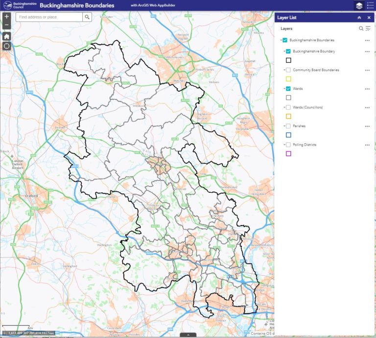
Air quality
Air quality can be assessed by the concentration of various pollutants in the air. The air quality indicator is compiled from four key air pollutants:
Data
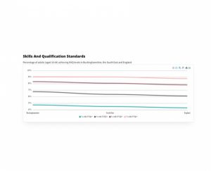
Highest Level of Qualification Held
Table showing the proportion of working age (16-64) residents by the highest level qualification they have in Buckinghamshire, the South East and England.