Air quality
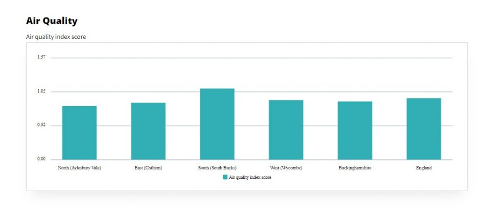
Air quality can be assessed by the concentration of various pollutants in the air. The air quality indicator is compiled from four key air pollutants: Nitrogen dioxide, Benzene, Sulphur dioxide, and Particulates.
Map of Buckinghamshire
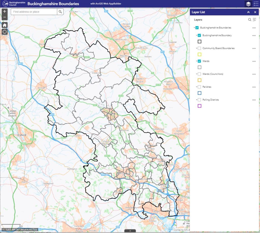
A boundary map is a map created for the purpose of outlining a boundary for an area and the areas next to it.
Fix my street
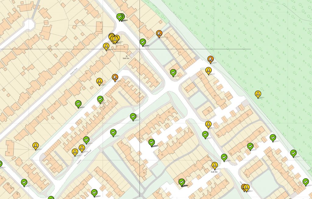
An online portal containing statistics on issues with place-based assets, for example, trees, parks, playgrounds, roads, and streetlights.
Achieving our shared vision for Buckinghamshire to 2050

This live document has been prepared by Buckinghamshire’s Growth Board and is designed to be the ‘go to’ place to find out about the vision for Buckinghamshire the place, where it is going, and what it is all about.
Library Information

This webpage from Buckinghamshire Council allows people to find information about their local libraries including opening hours, contact details and facilities.
Country Parks

This website from the Council contains detailed information on Buckinghamshire’s Country Parks including where they are, opening times, and parking information.
Broadband speeds and coverage
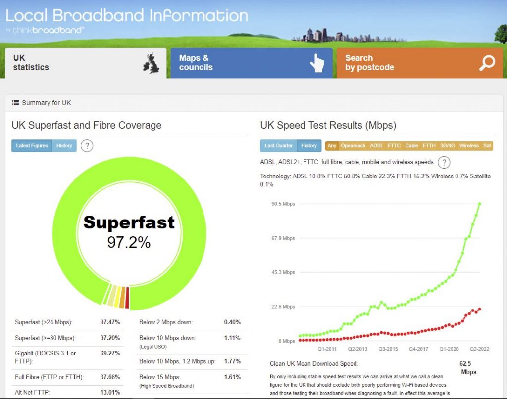
Local Broadband Information including superfast and fibre coverage, as well as UK speed test results.